
This Just In: The Sea Surface Temperature Off Ecuador Exceeds Records.
In its August update, NOAA’s National Weather Service reports this year’s El Nino is roaring along to record highs. NWS predicts that sea surface temperatures in the eastern Pacific will peak in the late fall/early winter near or exceeding 2 degrees C/ 3.2 degrees F above normal. “If this forecast comes true, it will place the 2015 event among the strongest El Niños in the (admittedly short) 1950-2015 historical record.”
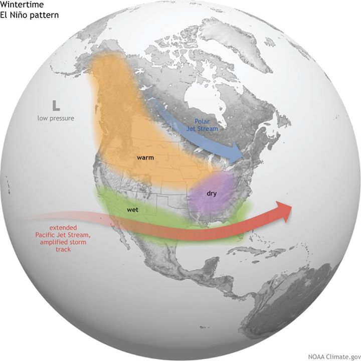
What this means is that forecasters can be assured the odds are growing that El Nino will play a role in various parts of the US as far as winter climate is concerned. As we reported earlier, a strong El Nino event brings wet and cool winter from the West Coast across the lower half of the US, drier and warmer in the Northern Rockies, Ohio Valley, Great Lakes and Northeast.
Credit: NOAA/NWS
So, we will most likely have a very different winter than we had last year, especially in the northeast where the snow depth and temperature will not come close to the near-Armageddon experience of last season.
To brush up on El Nino meteorology basics, click here.


